If you buy through affiliate links, we may earn commissions, which help support our product reviews.
Last Updated Feb 24, 2026
Whether you’re a professional surveyor or a landowner, there’s no escaping the fact: You require the best handheld GPS for surveying by your side. Unfortunately, in this era of constantly advancing technologies, discovering a device that perfectly matches your needs and requirements has always posed a challenge.
In this comprehensive guide, we will explore the top options available in the handheld GPS/GNSS market. Our goal is to help you elevate your surveying process to new heights.
As seasoned experts in the field of GPS, we will examine the strengths and weaknesses of each option, as well as key features like accuracy, portability, display, battery life, and software compatibility.
Join us as we delve into the various features and provide detailed reviews of each unit, empowering you to make an informed decision with confidence.
In a rush? Here’s a quick preview of our top picks:
Best GPS Devices For Surveying: Quick Preview
| Product Name | Review | Price | Rating |
|---|---|---|---|
SMAJAYU GNSS Surveying System | Jump to Review | $2701 Buy Now | 5 stars (10 ratings) |
Te-Rich Handheld GPS GNSS Receiver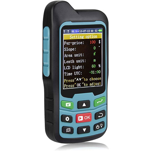 | Jump to Review | $92.98 Buy Now | 3.8 stars (138 ratings) |
GPS Land Surveying Meter | Jump to Review | $165.00 Buy Now | 2.7 stars (3 ratings) |
EM90 Handheld GPS | Jump to Review | $85.83 Buy Now | 3.5 stars (11 ratings) |
BEVA Mini Handheld GPS for Surveying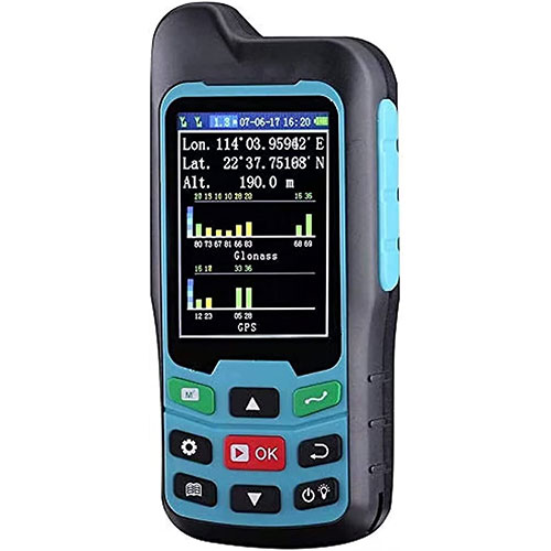 | Jump to Review | $92.98 Buy Now | 3.8 stars (170 ratings) |
Trimble R12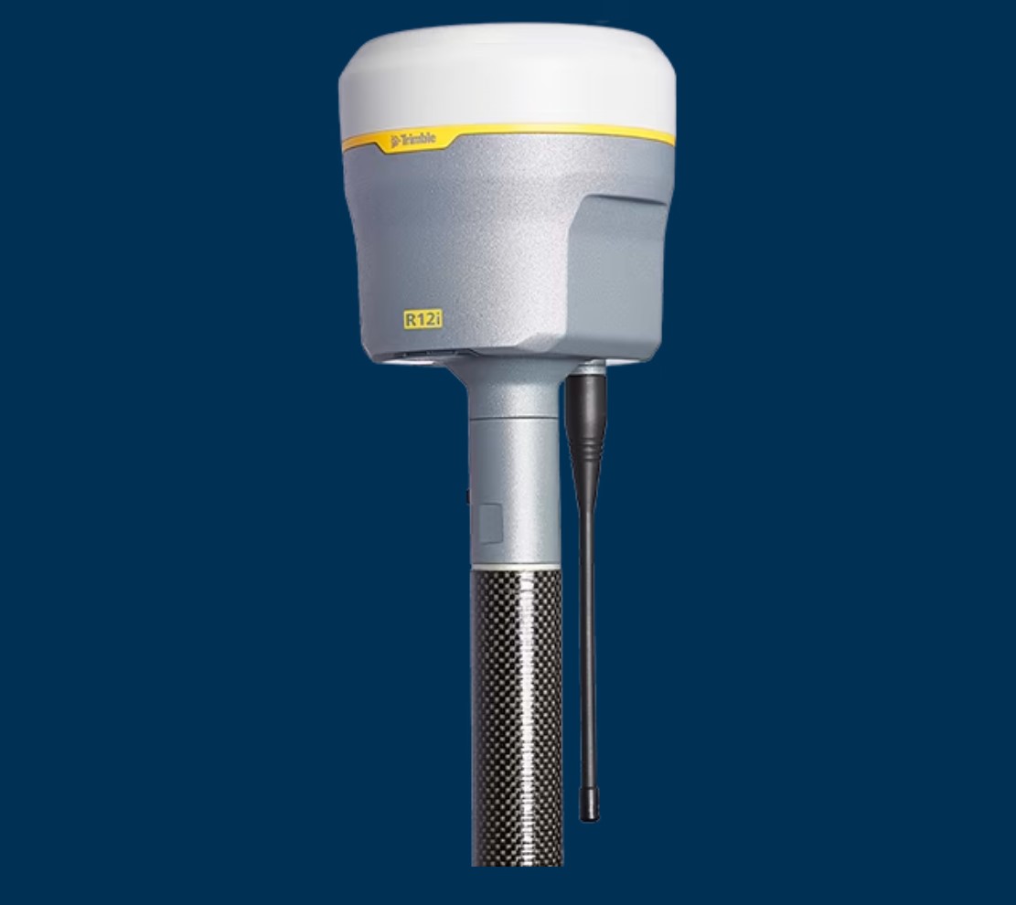 | Jump to Review | $20,950 Buy Now | 5 stars |
Expert Insights: Why Our Handheld GPS Reviews are Trustworthy
Our team at Trakkit brings together a unique blend of hands-on experience and technological insight that sets us apart in our reviews. I personally spent a decade in the field surveying property lines and construction sites as well as locating underground utilities.
My practical knowledge of what a surveyor truly needs in a GPS device forms the bedrock of our assessments. Beyond my own expertise, Trakkit’s team is composed of tech enthusiasts, always on the lookout for the latest and most innovative products.
We combine our real-world experience with a passion for tech to bring you reliable, trustworthy reviews that you can depend on when choosing your next handheld GPS device for surveying.
Now, let’s cover the basics.
Navigating the Basics: How Handheld GPS Devices Transform Surveying

Handheld GPS devices have revolutionized surveying, offering unprecedented accuracy and efficiency.
By connecting to satellites, these devices can locate themselves and record points of interest accurately.
The GPS receiver calculates distances between satellites and the device, using triangulation to determine precise coordinates.
User-friendly software allows for effortless recording and storing of location data, mapping topography and notable features.
Surveyors can now swiftly and accurately gather invaluable data on land attributes.
Key Surveying Terms Decoded: Understanding GPS/GNSS Technology
When it comes to the handheld GPS market, you should know a few important terms and features before choosing a suitable device for your surveying needs.
Global Positioning System (GPS)
GPS is a technological marvel that has revolutionized how we measure and map our world.

GPS provides accurate, three-dimensional coordinates of any location on the planet by using a broad network of satellites orbiting the Earth and a receiver on the ground. This makes surveying faster, more accurate, and more efficient than traditional methods. It is beneficial for surveying large areas, inaccessible or hazardous terrains, and monitoring natural disasters.
Surveyors can collect real-time data and create 3D models of construction sites, mapping projects, and infrastructure with GPS.
You can find more about how GPS works here.
Global Navigation Satellite Systems (GNSS)
In terms of surveying, GNSS is an essential satellite network that is widely used in the field. GPS.gov defines GNSS as any satellite constellation that provides positioning, navigation, and timing (PNT) services globally or locally.
This system accurately determines the height, position, velocity, and time for various applications, including surveying. With the ability to track multiple satellite signals simultaneously, GNSS allows for exact and efficient surveying measurements.
GNSS has become an integral part of modern surveying techniques and has played a vital role in shaping the field.
Accuracy is Everything
In the world of surveying, accuracy is everything. The 2 things that matter are Horizontal and Vertical position.
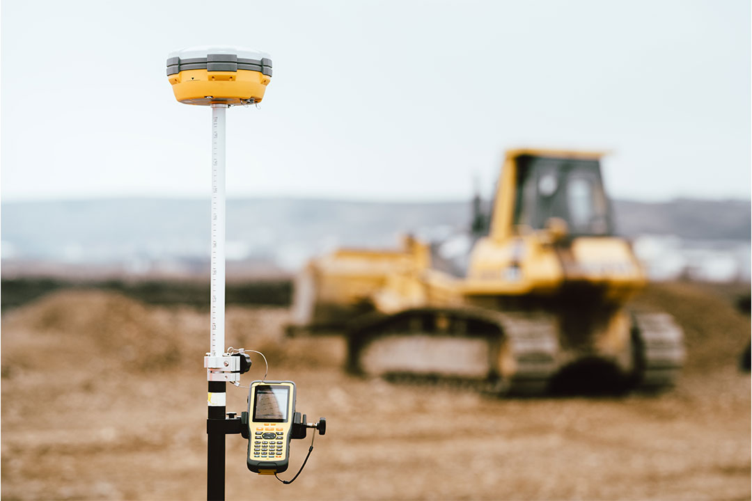
It does you no good just to know where your horizontal location is, like when using your phone to navigate to an address. You must also know the height at a given point. This is why professional survey equipment uses poles to mount the receiver.
For example, if I am sent to survey an area that is flooding all the time, after surveying and plugging the data into CAD software, we can see where the low spots are and calculate the amount of dirt needed to level the area. So, getting to a survey-grade sub-centimeter accuracy takes expensive GNSS receiver equipment.
If you just want a rough survey and don’t need that level of accuracy, inexpensive handhelds will do fine.
Geographic Information Systems (GIS)
GIS revolutionized data recording and mapping in surveying by integrating various data sources into layered maps. It enhances analysis, understanding, and decision-making for professionals in diverse applications like utility mapping, route planning, and environmental analysis.
Real-Time Kinematics (RTK-GPS)
RTK is an advanced GPS technique used by surveyors to obtain highly accurate real-time positioning data. It allows for faster and more precise measurements, with up to 100 times greater accuracy compared to standard GPS surveys. This is achieved by using a base station to send correction data to the rover, which updates the position almost instantly.
Most professional GNSS survey equipment can function as either a base or rover, providing flexibility in surveying operations. RTK is a groundbreaking technology that has revolutionized the surveying field, enabling unprecedented accuracy.
Real-Time Differential (RTD-GPS)
RTD is a highly precise method of surveying that relies on a radio transmitter at the base station to transmit pseudo-range and range rate corrections to the roving receivers in near-real time. This technique is essential for surveying applications that require high accuracy and precision, such as construction or land development.
Using RTD-GPS, surveyors can ensure that their measurements are accurate within a few centimeters, even in challenging environments like densely populated urban areas or rugged terrain.
See our detailed reviews of the best handheld GPS devices for surveying below:
In-Depth Reviews: The 6 Best Handheld GPS for Surveying
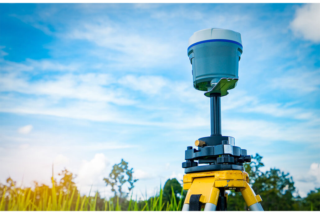
SMAJAYU R26 GNSS Surveying System with LP80 Handheld RTK-GPS
GPS Type: GNSS / RTK-GPS
Included: Rover & Base
Battery Life: 14 hours
Accuracy: 1 centimeter
Weight: 9.39 lbs.
Model #: R26
Details & First Impressions:
The SMAJAYU GNSS Surveying System LP80 Handheld RTK-GPS is a powerful combo that combines the latest GPS technology with a handheld and base station design. With centimeter-level positioning accuracy, surveyors can obtain precise measurements in real-time.
It features Bluetooth, radio, storage, positioning, inertial navigation, antenna, and other modules for maximum efficiency.
The device supports multiple satellite systems like BDS, GPS, GLONASS, and Galileo, ensuring accurate readings in challenging environments.
The 10000mAh battery offers up to 14 hours of continuous use, perfect for surveying large areas without external power.
Pros
- Centimeter-level positioning accuracy
- Supports multiple satellite constellations
- 10000mAh battery provides up to 14 hours of life
- Ergonomic shape and lightweight construction
- Sleek, modern all-black exterior design
Cons
- No tripod included
Performance and Overall Experience:
We had a great experience with the SMAJAYU R26 Surveying System and LP80 Handheld RTK-GPS. It performed exceptionally well in challenging environments with centimeter-level accuracy. The device impressed us with its wide range of features, including Bluetooth, radio, storage, positioning, inertial navigation, antenna, and other modules.
We also liked its 14-hour battery life and lightweight construction, making it ideal for surveying larger areas without external power. Lastly, we appreciated its sleek and modern all-black design.
The SMAJAYU GNSS Surveying System is an excellent handheld GPS for reliable and accurate surveying.
Tested Features:
- Accuracy
- Battery life
- Rover and base station setup
- Satellite connectivity
- Wireless control
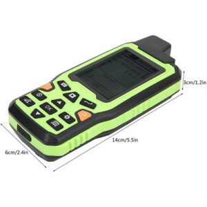
Te-Rich Handheld GPS GNSS Receiver

GPS Type: GNSS/GLONASS
Battery Life: 32 hours
Accuracy: Within 5 feet
Weight: 6.3 ounces
Model #: 6543857349
Details & First Impressions:
The Te-Rich Handheld GPS GNSS Receiver is a powerful surveying tool that combines the latest GPS and GLONASS satellite systems with an easy-to-use design.
With 5 feet accuracy, 32 hours of battery life, and weighing only 6.3 ounces, it maximizes efficiency.
This sleek and modern device features an ergonomic design for comfortable extended use, a 2.4 inch LCD screen for clear readings, and a rechargeable battery that lasts 32 hours. It supports GPS and GLONASS for accurate readings on any land.
Pros
- 32 hours of battery life
- Ergonomic design
- 2.4 inch LCD screen
- Compact and lightweight
Cons
- No wireless control features
- 5 feet of accuracy
Performance and Overall Experience:
Our team liked the Te-Rich Handheld GPS GNSS Receiver. The device performed exceptionally well in challenging environments, even with the 5 feet of accuracy. We were also impressed by its 32 hours of battery life. After a full charge, we didn’t have to worry about charging it again for a while.
The 2.4″ LCD screen was easy to read in most conditions while still compact enough to carry around on any survey mission. Furthermore, we liked that it supported GPS and GLONASS navigation satellites.
Tested Features:
- Accuracy
- Battery life
- Satellite connectivity
- Ease of use
- Readability
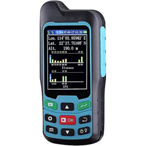
GPS Land Surveying Meter – Professional Grade Handheld GNSS Receiver
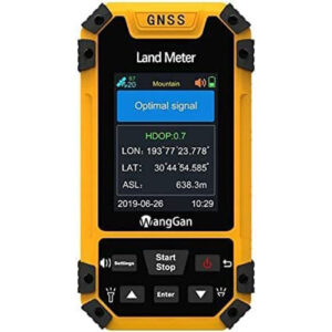
GPS Type: GPS, GNSS, SBAS, BeiDou
Battery Life: 6 hours
Accuracy: Within Feet
Weight: 120g (No battery)
Model #: B0BJ6DWGDF
Details & First Impressions:
We recently acquired the GPS Land Surveying Meter, a lightweight and portable handheld GNSS receiver. With a weight of just 120g (battery not included), this device offers about 6 hours of battery life and impressive accuracy.
Setting up and using this device was pleasantly straightforward, thanks to its intuitive 2.4″ color screen.
It’s suitable for both tech-savvy and non-tech-savvy individuals.
The device supports GPS, GNSS, SBAS, and BeiDou satellite signals, ensuring quick and accurate reception. However, it’s important to note that this meter is not compatible with Macs.
Pros
- Lightweight and Portable – just 120g without the battery
- Easy to set up and use
- 2.4″ color screen for intuitive surveying
- Features a wide range of satellite signals (GPS, GNSS, SBAS & BeiDou)
Cons
- It does not work with Mac computers or devices
- Limited range of features compared to other professional grade models
- Only 6-hour battery life
Performance and Overall Experience:
The performance of the GPS Land Surveying Meter was impressive. We could quickly and accurately receive all satellite signals, such as GPS, GNSS, SBAS & BeiDou. The 2.4″ color screen worked well for intuitive surveying and made it easy to use. It also ran smoothly and didn’t lag or struggle to keep up with our quick navigation.
Overall, we had a great experience testing this professional-grade handheld GNSS receiver. While it has limited features compared to other high-end models on the market, it is an excellent option for those who want a low-cost, reliable device for surveying land areas. It is also one of the best budget handheld GPS out there.
Tested Features:
- Land area measurements
- Range of satellite signals (GPS, GNSS, SBAS & BeiDou)
- Performance
- Accuracy
- Battery life
EM90 Handheld GPS Land Area Measurer
GPS Type: GPS
Battery Life: 12+ hours
Accuracy: ≤1.5m
Weight: 13.1 ounces
Model #: EM90
Details & First Impressions:
The EM90 Handheld GPS Land Area Measurer is an excellent tool for surveying professionals. With a waterproof and ergonomic design, it provides precise measurements using a U-BLOX chip.
It offers real-time tracking, automatic area/slope/elevation measurement, and impressive battery life of up to 12+ hours. Easy to set up and calibrate, it delivers accurate results every time.
Pros
- Waterproof and durable design
- U-BLOX chip for precise measurements
- Ergonomic design
- LED backlight
- Real-time tracking capabilities
- Automatic area, slope, and elevation measurements
Cons
- It can be challenging to set up and calibrate for new users
- Not suitable for anything other than land measurement
Performance and Overall Experience:
The EM90 Handheld GPS Land Area Measurer performed exceptionally well in our tests. Once I familiarized myself with the device and its controls, the setup and calibration process was relatively simple. The measurements were highly accurate, exceeding expectations.
The U-BLOX chip provided increased precision with minimal errors, making it reliable for professional surveying. The ergonomic design offered comfort and a secure grip, reducing fatigue.
The LED backlight of the EM90 was helpful in low light conditions, ensuring accurate readings at any time of the day.
Its real-time tracking capabilities streamlined project monitoring without manual recording. The automatic area, slope, and elevation measurements significantly improved efficiency without compromising accuracy.
Our experience using this product has been overwhelmingly positive. With its ease of use, impressive accuracy, and high precision, the EM90 Handheld GPS Land Area Measurer is ideal for surveying professionals. Highly recommended!
Tested Features:
- Land area measurements
- Range of satellite signals (GPS, GNSS, SBAS & BeiDou)
- Performance
- Accuracy
- Battery life
BEVA Mini Handheld GPS for Surveying
GPS Type: GPS, GLONASS
Battery Life: 12 Hours
Accuracy: ≤1.5m
Weight: 0.39lb
Model #: CM84
Details & First Impressions:
I was impressed with the BEVA Mini GPS Unit for Surveying. This unit has features that make it perfect for measuring farmland and other areas. It has GPS and GLONASS satellite system support and a super strong signal that provides instant and precise positioning. The accuracy of this device is highly impressive, offering area measurement errors of no more than 1-2%.
The BEVA mini handheld GPS accurately measures the area and length of any shape, including mountains, slopes, and flatlands. Its exceptional performance is coupled with a waterproof and dustproof design, making it the perfect device for outdoor use.
Pros
- GPS and GLONASS satellite support
- Super strong signal for precise positioning
- Area measurement error of 1-2%
- Accurately measures any shape, area, or length
- Waterproof and dustproof design
Cons
- Older tech
Performance and Overall Experience:
I was pleased with the overall performance of the BEVA Mini Handheld GPS for Surveying. The accuracy of this device was unparalleled compared to other GPS devices I have used, with a satellite accuracy of less than 1.5 meters. It accurately measured the length and area of any shape, from straight lines to curves or mountainous terrain. I particularly liked its waterproof and dustproof construction, which allowed me to use it outdoors in all kinds of weather conditions without worry.
The battery life was also sufficient, lasting up to 12 hours and providing plenty of time for land surveying tasks. The small size and light weight also made it easy to carry around. Overall, I recommend this device for anyone needing accurate land or construction site measurements.
Tested Features:
- GPS and GLONASS satellite support
- Signal Strength
- Area Measurement
- Accuracy
- Waterproof and dustproof design
- Digital compass
- Battery life
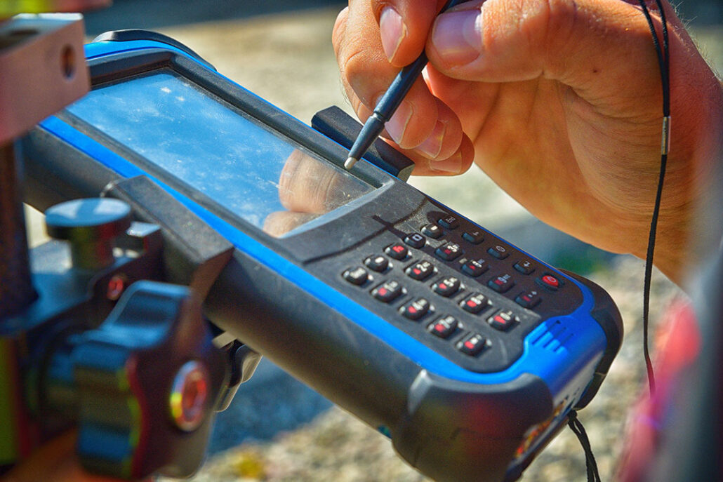
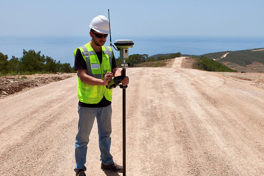
Trimble R12 – Professional Survey Grade GPS/GNSS Receiver
 GPS Type: GNSS RTK Receiver
Battery Life: 14 hours
Accuracy: 8mm H/ 15mm V
Weight: 2.47 lbs.
Model #: R12
Details & First Impressions:
The Trimble R12 impresses right from the start with its robust construction and practical design. It’s lightweight, ergonomic, and perfect for field use. Equipped with ProPoint GNSS technology, it ensures enhanced performance even in challenging conditions. Plus, it features Trimble SurePoint for precise positioning, Trimble CenterPoint RTX for augmented accuracy, and Trimble Access software for efficient data collection. No subscriptions required for the R12 or TSC5.
For this receiver, a reliable data collector like the Trimble TSC5 is a popular choice.
The Trimble R12 offers a high-performance experience in a user-friendly package, catering to all levels of tech-savviness. With superior connectivity options, you can stay connected no matter where you are, which is especially useful in remote areas.
Pros
- Excellent GNSS Performance
- Correction Service
- Efficient Data Collection
- Rugged and Durable
Cons
- High Price
Performance and Overall Experience:
The Trimble R12 exhibits remarkable performance. Its advanced features collaborate seamlessly to deliver accurate and reliable data. The device’s tough and resilient design makes it ideal for use across various conditions, establishing it as a dependable field companion. However, this stellar performance is accompanied by a high price, which could be a potential barrier for some.
As for the overall user experience, the Trimble R12 is quite gratifying. It’s apparent that the device has been crafted keeping the end-user in mind, with features like an intuitive interface and superior connectivity options. The device also boasts a long battery life, allowing you to use it for prolonged periods without the worry of recharging. This proves exceptionally useful when working on extensive projects in remote areas.
Tested Features:
- ProPoint GNSS technology
- Trimble SurePoint technology
- Trimble CenterPoint RTX correction service
- Trimble Access software
- Device durability and ruggedness
Essential Features to Seek in Your Next GPS Unit for Surveying Projects

When surveying, having a reliable and accurate handheld GPS unit is essential. But with a wide range of GPS units available, it can be confusing with what to look for. When selecting a device, there are several essential features to keep in mind:
- Accuracy: Accuracy is crucial when choosing a handheld GPS unit, especially for surveying purposes. Look for devices with high precision and accuracy down to the centimeter range. In your search, consider exploring options for the most accurate handheld GPS for surveying, as these units are specifically designed to meet the high-precision demands of professional surveying.
- Display: An excellent handheld GPS unit will have a clear and easy-to-read screen, so you can easily see readings in any environment.
- Battery Life: Long battery life is essential for surveying, as the device will likely need to be used for extended periods without access to an external power source. When searching for a device, choose a durable battery that can provide sufficient power for your needs.
- Connectivity: Most handheld GPS units now have wireless connectivity, allowing users to access their handheld devices remotely or stream data in real time. This is especially useful for surveying larger areas or tracking mobile objects.
- Software: The software that comes with a handheld GPS unit can be just as essential as the hardware. Look for units with specialized surveying software that allows you to efficiently record and store data, create maps, and more. Also, ensure the software is compatible with the other applications you will be using. Make sure you are not purchasing a handheld GPS for hiking as they have different purposes and software installed.
- Weatherproofing: Surveying can take you to unexpected places and weather conditions. Look for a weatherproof and dustproof device to ensure it will survive the harshest conditions.
- Durability: Durability is essential when selecting a handheld GPS device for surveying. It’s important to find durable handheld devices built to endure regular use in all conditions.
When you understand what exactly to look for when choosing a GPS unit for surveying, you can be sure to find the ideal device for your needs.
How To Choose the Best Handheld GPS for Your Surveying Needs
Various professionals can utilize handheld GPS devices for surveying purposes. Here are some professions that commonly use handheld GPS devices and the features they should prioritize:
Land Surveyors
Land surveyors depend on handheld GPS devices for precise land measurement and mapping. High-precision devices with real-time positioning and features like differential correction and survey-grade antenna support are crucial. User-friendly data collection and mapping functionalities, including point recording and storage, should also be prioritized.
Environmental Scientists
Environmental scientists use GPS devices for mapping and analyzing ecological features like vegetation, water bodies, and wildlife habitats. Good battery life and solar charging capabilities are important for fieldwork. Compatibility with GIS software is essential for seamless integration and data analysis. Detailed location attributes are valuable for precise environmental mapping.
Archaeologists
During fieldwork, archaeologists need handheld GPS devices to accurately record the locations of archaeological sites, artifacts, and features. Choosing a device with solid satellite reception is essential, even in challenging environments such as dense forests or rugged terrain.
It’s helpful to have a device that can store and manage many waypoints with customizable data fields to organize archaeological data effectively. Other valuable features include compasses and inclinometers, which can assist in accurately aligning and documenting excavations. We also wrote an article about the best handheld XRF analyzers if you are interested. Used for determining the percentages of precious metals.
Forestry Professionals
When selecting a GPS unit for forestry surveying, it is crucial to prioritize devices with strong signal reception, as they may need to work in dense tree canopies or rugged terrain.
Mapping and navigation features such as pre-loaded topographic maps and trail tracking would help navigate through forests. A durable design is essential to withstand the demanding outdoor conditions typically encountered in forestry work.
Civil Engineers
Civil engineers rely on handheld GPS units for tasks like land surveying and infrastructure planning. When choosing a device, accuracy in the centimeter range is crucial for precise measurements in engineering projects.
Connectivity features like wireless data transfer and Bluetooth compatibility improve field efficiency. Baseline measurements and coordinate transformations aid integration with engineering software.
Your Ultimate Guide to Using GPS for Precision Surveying
To begin, you’ll need a few important pieces of equipment;
- Handheld GPS Device: This tool is crucial for collecting data. Look for a reliable device with a long battery life. Popular brands like Trimble are recommended.
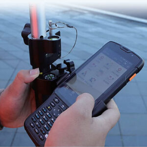
- GPS Receiver/Rover Combo: This equipment combo receives signals from the GPS satellites. Sends them to your handheld device resulting in highly accurate positioning. It is usually mounted on a pole for portability and good signal acquisition.
- Mapping Software: You’ll require this software to analyze and interpret the data collected by your GPS device. Examples include ArcGIS, QGIS, and Google Earth.
Now let’s go through the six steps involved in utilizing the GPS for surveying;
Step 1: Planning
Before diving into data collection, proper planning is crucial. Determine the area you’ll be surveying and identify any potential obstacles, such as buildings or dense vegetation.
Step 2: Setting Up Equipment
Once your survey plan is ready, it’s time to set up your equipment. Start by turning on both your GPS device and receiver while ensuring they establish communication. Additionally, calibrate your device to guarantee data collection.
Step 3: Gathering Information
To begin, make sure your device is ready and then start gathering information. Take a walk around the survey area. Make occasional stops to note down points of interest. These could be things like property boundaries, landmarks, or any other relevant features you come across.
Step 4: Transferring Information to Mapping Software
Once you have collected all the data, it’s time to transfer it to your mapping software. Generally, this involves connecting your GPS device to a computer and uploading the data.
Step 5: Analyzing the Data
Once your data is in the mapping software, you can start analyzing it. This might include creating maps identifying any patterns that emerge from the data or calculating areas of interest.
Step 6: Applying Your Survey Data
Finally, you can put your survey data to use for various purposes. This could involve planning construction projects, designing landscapes or gardens, determining property boundaries managing farmland effectively. The possibilities are endless!
Remember that successful surveying requires planning, accurate data collection techniques, and thoughtful analysis. By following these steps, you’ll soon become adept at how to use a handheld GPS for surveying.
Final Thoughts
By understanding your specific requirements, you can easily identify the optimal handheld surveying GPS device. With a wide range of features available, it is crucial to determine which ones will suit your needs most effectively, enabling you to complete your tasks with greater speed and accuracy.
If you are new to surveying or uncertain about the ideal device for your needs, you can always seek guidance from the experts at Trakkit. Our team of experienced tech professionals will be delighted to assist you in finding the perfect GPS unit for your next project!
Frequently Asked Questions About Using a Handheld GPS Device for Surveying
How accurate is GPS for surveying?
A Global Positioning System (GPS) device can be highly accurate when used for surveying. It can provide positioning information with an accuracy of less than one meter in many cases and even down to the centimeter range with differential correction.
What is the most accurate handheld GPS device for surveying?
The SMAJAYU GNSS Surveying Rover System is the most accurate handheld GPS device for surveying. It features high-precision, fast-tracking RTK-GPS technology and supports survey-grade antennas for accuracy down to the centimeter range.
What is the difference between GPS and GNSS surveying?
GPS and GNSS surveying are methods used to measure field positioning accurately. While GPS is limited to information from satellites operated by the US government, GNSS utilizes data from multiple satellite systems such as Galileo, GLONASS, and BeiDou.
What is the difference between GPS and GIS in surveying?
GPS is a location-based technology that collects and stores positioning data for surveying purposes. GIS (Geographic Information System) utilizes GPS data to generate maps containing geographic information such as roads, underground utilities, buildings, boundaries, elevation, etc.
What is the most accurate GPS for mapping?
The SMAJAYU GNSS Surveying Rover System paired with GIS equipment is the most accurate for mapping. It features high-precision fast-tracking RTK-GPS technology and supports survey-grade antennas for accuracy down to the 1-centimeter range.