If you buy through affiliate links, we may earn commissions, which help support our product reviews.
Last Updated Sept 22, 2023
Surveying has always been crucial in various industries, playing a pivotal role in construction, engineering, archaeology, agriculture, and more. However, with the advent of GPS (Global Positioning System) technology, surveying has experienced a significant transformation, revolutionizing the way measurements and data are collected in the field.
Discover how to use handheld GPS for surveying with this comprehensive guide. Uncover the secrets to optimally utilizing these devices with finesse, ensuring accurate results and improved productivity.
We will explore these advanced tools’ remarkable capabilities and features and provide a step-by-step walkthrough on effectively leveraging this cutting-edge technology to enhance the accuracy, efficiency, and precision of your surveying projects.
Get ready to take your surveying endeavors to the next level as we embark on this journey, unlocking the true potential of handheld GPS technology and empowering you to achieve outstanding results in your surveying projects. Let’s dive in!
Deciphering GPS Surveying Equipment
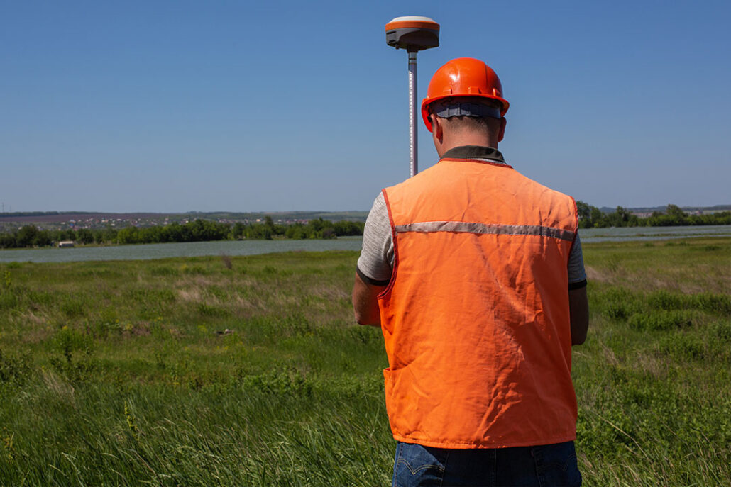
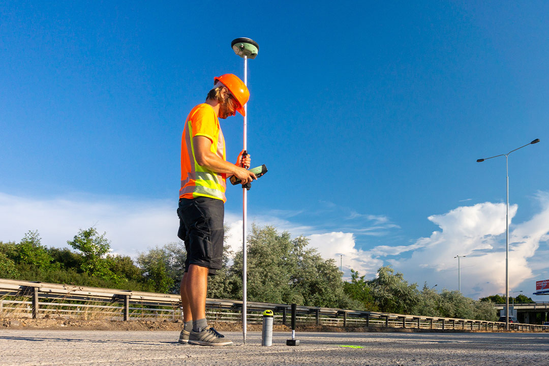
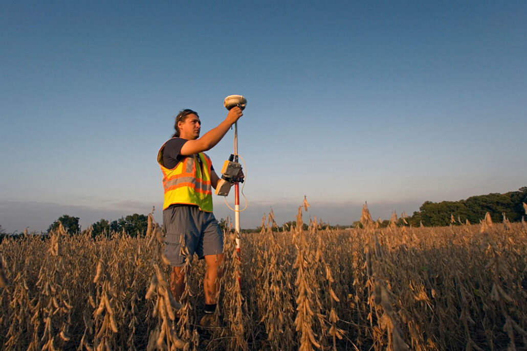
Handheld GPS units are compact, user-friendly gadgets that utilize advanced technology to pinpoint your exact location on Earth by establishing communication with a network of satellites orbiting our planet.
These nifty devices offer many benefits for surveyors, allowing them to effortlessly navigate various terrains and environments with utmost precision and efficiency.
Handheld GPS units have become an essential tool for surveying professionals, offering intuitive operation, precise accuracy, and real-time data acquisition capabilities. With these devices, surveyors can gather comprehensive and dependable information for various applications, ensuring reliable results and enhancing efficiency in the field.
Whether mapping out land boundaries, conducting topographic surveys, or performing construction layout tasks, the versatility and reliability of handheld GPS units make them an invaluable asset for professionals in the surveying industry.
Equipment Needed to Survey with GPS Successfully
To successfully carry out a GPS survey, having the proper set of equipment is crucial. This includes but is not limited to:
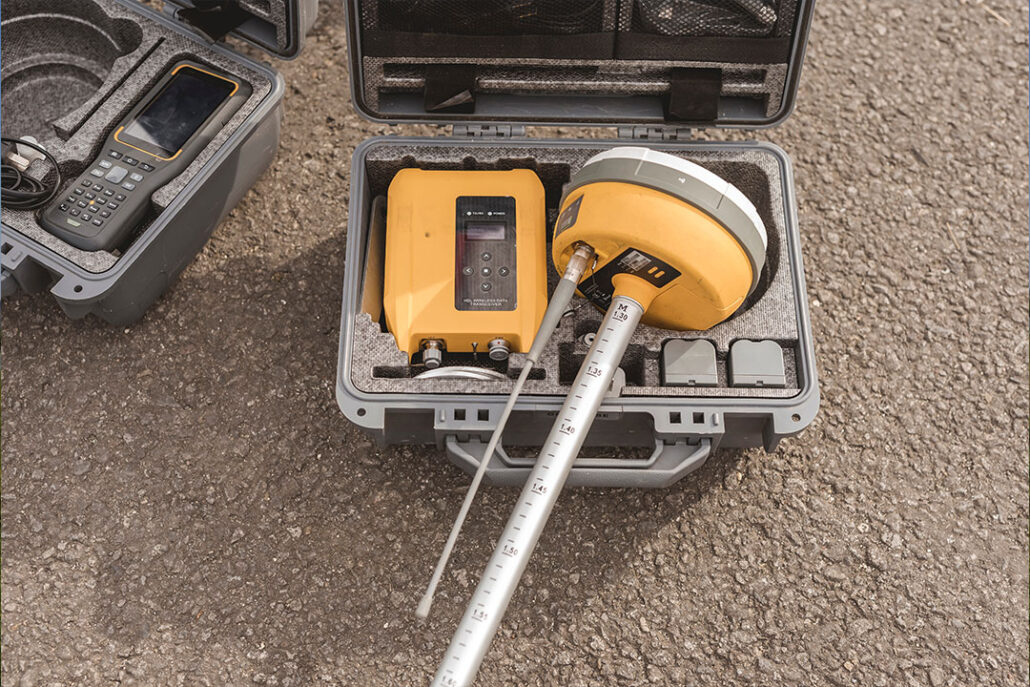
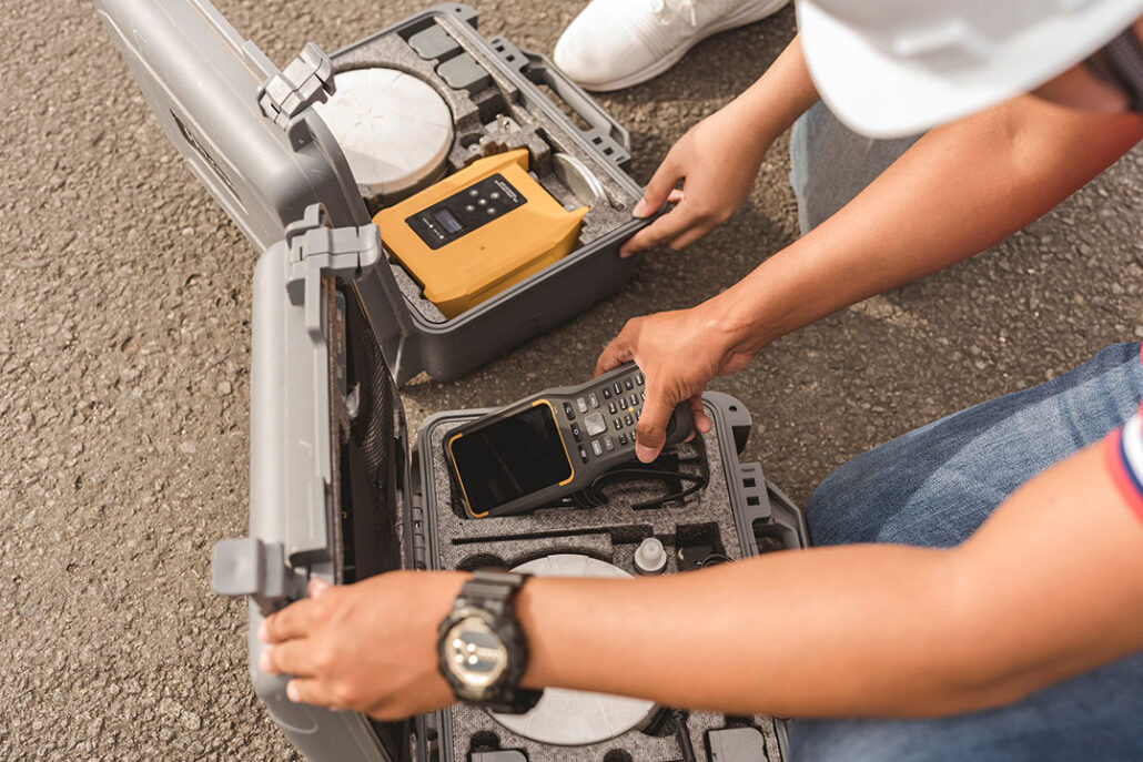
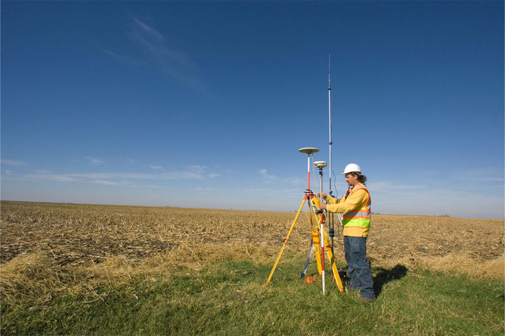
- GPS Receiver: The key instrument that receives signals from GPS satellites and translates them into location data. Enhanced receivers may feature multi-band channels, built-in Bluetooth, and Wi-Fi technology.
- GPS Rover Rods: Essential for extending the rover’s reach, these rods are crafted from various sturdy materials and available in varying lengths.
- GPS Poles: These lightweight yet robust poles are vital for securely mounting your GPS surveying equipment.
- GPS Bipods/Tripods: Adjustable-length bipods and tripods are your go-to options for added stability when setting up your equipment.
- GPS Antennae: A crucial component that boosts signal reception from satellites. While some systems have internal antennae, external ones can significantly enhance the signal.
- Total Station: This versatile tool integrates an electronic theodolite, EDM device, and software to accurately calculate the coordinates of survey points. Some models even incorporate GPS technology for superior precision.
- GPS for Toolboxes: If you’re carrying expensive tools in the field, consider using a GPS tracker for your toolbox for added security.
Setting Up Your Handheld Global Positioning System: The Preliminaries
To make the most of your handheld GPS unit for surveying, follow these steps to ensure proper setup:
- Fit the batteries and power up the device.
- Choose your preferred language and acknowledge your agreement with the terms and conditions.
- Familiarize yourself with the intuitive interface, which typically includes a menu with features like maps, compasses, waypoints, and settings.
- Take some time to navigate through these options to understand their functions.
- Ensure accurate calibration by setting your location, date, and time and allowing the device to synchronize with the GPS satellites.
Following these steps will allow you to use your handheld GPS unit effectively and efficiently.
Utilizing a Handheld GPS Receiver for Surveying with Accurate and Reliable Data
Leveraging a handheld GPS receiver for surveying involves several vital steps to ensure accurate and reliable processes for collecting data. If you’re new to GPS technology, you may want to start by learning how to get GPS coordinates on your phone.
- Marking Waypoints: A waypoint is a specific geographical point defined by longitude and latitude coordinates. To mark a waypoint, navigate to the waypoint menu on your device, then select the ‘mark’ option. The GPS receiver will capture your current location as a waypoint, allowing you to quickly refer back to it during your survey.
- Navigating to Waypoints: Once you have marked your waypoints, you can seamlessly navigate between them using your handheld GPS receiver. Select the desired waypoint from your list, and the device will provide accurate directions, guiding you to the selected location with precision and efficiency.
- Recording Tracks: Besides marking waypoints, most handheld GPS units also offer the functionality to record tracks. Tracks are routes between different locations that you can traverse. This feature is handy when mapping out large areas or exploring unfamiliar terrain. Registering your tracks allows you to visualize your path and analyze your land surveying progress more comprehensively.
Remember to save your data frequently to safeguard against any potential loss of vital information. Regularly backing up your survey data finally ensures you can access and analyze your findings confidently and safely.
By following these steps and utilizing the advanced capabilities of a handheld GPS receiver, you can enhance the accuracy and reliability of your land surveying efforts, ultimately leading to more precise and valuable data collected.
Overcoming Challenges with the GPS Receiver and Troubleshooting Tips
While using a handheld GPS unit, you may encounter common hiccups affecting performance. One such hiccup is signal interference, which can occur when you are in an area with towering buildings or dense foliage. To overcome this, moving to a more open space where the device can receive a clear signal is recommended. To understand more about how GPS works in different conditions, you can read about whether GPS works without data.
Another area that you may come across is accurate readings. To address this, verifying that your GPS device is calibrated correctly is essential. Checking the calibration settings and making necessary adjustments can significantly improve the accuracy of the readings.
In some cases, you may experience device malfunctions. If this happens, it is advisable to refer to the manufacturer’s manual for troubleshooting steps or contact their customer support for assistance. They will be able to provide you with the necessary guidance to resolve any device-related issues.
Although a handheld GPS device is typically straightforward, it is crucial to remain mindful of these potential concerns and take necessary precautions for optimal performance and dependable navigation.
Preserving Survey Data on Your Handheld GPS Device
To ensure the longevity of your handheld GPS device, it’s crucial to establish a regular cleaning routine. To ensure the longevity of your device, opt for a soft, damp cloth to delicately cleanse any dirt or debris. Avoid harsh chemicals that may pose a potential threat to its integrity and functionality. When not in use, find a cool and dry place to store it, protecting it from excessive heat or moisture.
In addition to regular cleaning, conducting periodic maintenance checks is vital. Stay mindful of the battery life, watching for any signs of decline. It’s also advisable to check for mapping software updates regularly, as these updates often bring improvements and enhancements to the device’s functionality. Furthermore, recalibrating the device will help maintain its accuracy and reliability.
If you encounter any significant issues or concerns with your handheld GPS, it’s always wise to seek assistance from a professional. Their expertise and knowledge will ensure that problems are addressed effectively, allowing you to continue relying on your device for accurate navigation and exploration.
Final Thoughts on How to Use Handheld GPS for Surveying
Handheld GPS units have revolutionized the land surveying industry, providing unparalleled convenience and precision. With these cutting-edge gadgets at your disposal, you can significantly enhance your land surveying efficiency and accuracy.
By mastering the operation and maintenance of handheld GPS devices, you can optimize their performance and fully capitalize on their capabilities. Familiarize yourself with the various features and functions, such as real-time positioning, satellite connectivity, and GPS data logging, to unlock the full potential of these devices.
Moreover, to enhance your land surveying capabilities, it is extremely important to stay ahead of the latest advancements in GPS technology and software. Continually explore available resources, participate in industry events, and engage in professional discussions to expand your knowledge and uncover innovative techniques.
For those seeking guidance on the best handheld GPS devices for surveying, we invite you to explore our comprehensive article on the Best GPS for Surveying. Discover in-depth reviews, comparisons, and recommendations to help you make an informed decision and choose the perfect device to elevate your surveying endeavors.
Frequently Asked Questions About Handheld GPS for Surveying
What is the process of land surveying through handheld GPS?
Land surveying with a handheld GPS is a fairly straightforward process. The first step involves the user connecting to a known point using satellites or the Global Positioning System (GPS). This known point is used as a reference for all measurements taken after.
Once connected, the user can record features within their immediate area by entering coordinates into the device and measuring distances from the known point. The recordings are stored in the GPS unit. They can be later uploaded to a desktop computer or other device for further analysis.
How does a handheld GPS device work?
A handheld GPS device uses satellite signals to pinpoint the user’s real-time location accurately. These signals, transmitted from a network of Earth-orbiting satellites, are received by the GPS unit. The device’s internal software processes this information and calculates precise coordinates, providing the user with their exact location. To learn more about how GPS works, click here.
How does a surveyor use GPS?
Surveyors use GPS to determine the coordinates of various points on a map accurately. Surveyors do this by connecting to a known point (such as a specific landmark or survey marker) and measuring distances from that point to other parts of the map. This information can then create maps or charts that accurately depict the area surveyed.
What is the difference between GPS and GNSS surveying?
GPS and GNSS surveying are methods used to measure field positioning accurately. While GPS is limited to information from satellites operated by the US government, GNSS utilizes data from multiple satellite systems such as Galileo, GLONASS, and BeiDou.
GNSS surveying is usually more accurate than GPS surveying alone because it uses a broader range of satellite constillations.
References
Consider exploring resources from reputable websites such as GPS.gov and the American Association for Geodetic Surveying for more comprehensive information on GPS technology and surveying.